

Let’s face it — no one likes being hit with an unexpected charge mid-journey. While most UK toll roads are few and far between, the ones that do exist can still catch drivers out. From motorway stretches to river crossings and city zones with congestion charges, these paid routes are dotted across the country. The good news? They’re becoming less common, with a few bridges recently scrapping fees altogether. But there are still some you’ll want to watch out for — and that’s where we come in.
There’s very little standardisation to UK road tolling, other than it generally costing more to use a toll road the larger and heavier your vehicle is – in many places, motorcycles and scooters can use these routes for free. As technology evolves, the method of payment is changing too. Where you might have needed cash in the past, today you can typically use contactless payment, pre-pay, or register for discounts on regularly used routes – all enforced by the use of automatic number plate recognition (ANPR) cameras.
In our guide below you’ll find 15 major toll routes, three of which have become free to use in recent years. We explain how you can pay, and how you can avoid some of these roads entirely, and we’ve also listed a number of other smaller and cheaper toll roads you might come across as you drive around the UK. The cheapest costs just five pence…
- Batheaston Bridge
- Cleddau Bridge
- Congestion Charge London
- Dartford Crossing
- Dunham Bridge (free)
- Forth Road Bridge (free)
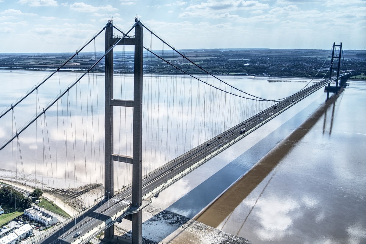
- Humber Bridge
- Itchen Bridge
- M6 Toll
- Mersey Gateway
- Mersey Tunnels
- Tamar Bridge
- The Severn Bridges (free)
- Tyne Tunnel
The 12 tolls of the UK:
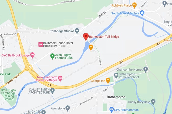
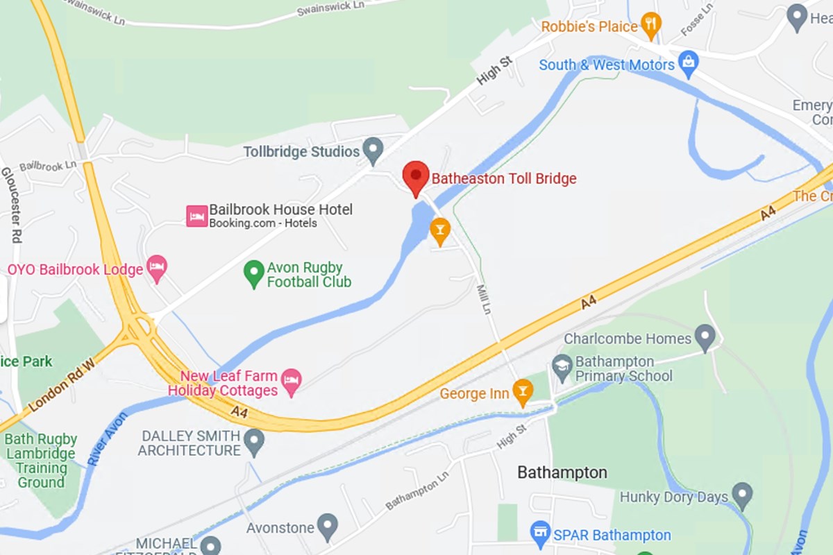
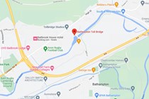
Batheaston Bridge
Where is it found? This arch bridge crossing the River Avon is on a minor road, just off the A4, somewhat unsurprisingly east of Bath is a Grade-II listed bridge.
How much does it cost and how do I pay? Buses: £2.00 Caravans: £1.50 Cars: £0.80. In true Jane Austen fashion, it’s cash only at toll booths, so save your shrapnel.
What’s the alternative route? If you’re looking to go north, stay on the A4 until it joins the A46 and approach south. Or take the exit at the roundabout to head northwest on the London road, following the curve of the river but not crossing it (again).
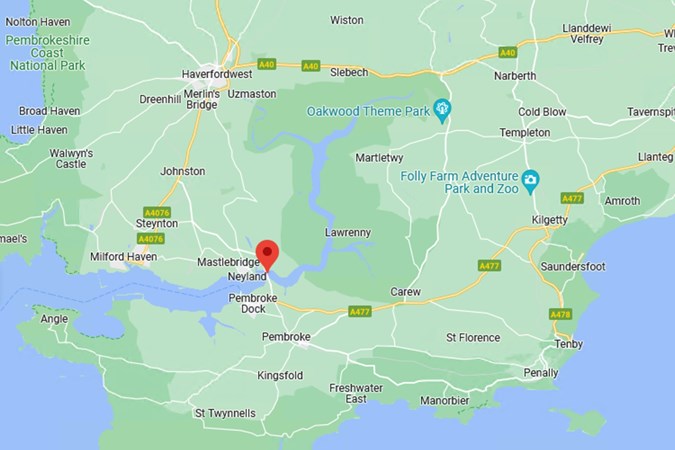
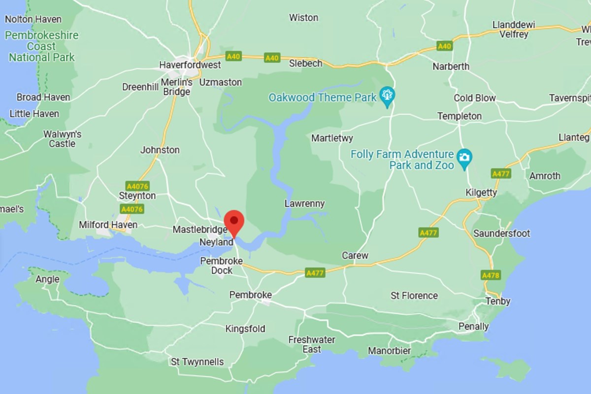
Cleddau Bridge
Where is it found? On the A477 taking drivers from the northern end of Pembroke dock north of the Cleddau where Pembrokeshire continues to deliver picturesque villages and delightful country views, east in Pembroke National Park or west towards Milford Haven and Fishguard.
How much does it cost and how do I pay? The toll for the Cleddau bridge was removed on April 1, 2019 after 44 years, and remains free at the time of writing.
.
What’s the alternative route? With no other crossings across the Cleddau, drivers need to skirt the eastern boundary of Pembroke National Park using A40 then A477 or vice versa if the bridge is closed. This will add significantly more miles to your journey.
Congestion Charge London
Where is it found? Central London, bordered by Hyde Park to the west, Vauxhall to the south, Tower Bridge to the east, and the A501 going past St. Pancras to the north.
How much does it cost and how do I pay? Daily charge is £15 if you pay in advance or on the same day or £17.50 by midnight of the third day after travel. Charges apply 07:00-18:00 Mon-Fri, 12:00-18:00 Sat-Sun and bank holidays, with no charge between Christmas Day and New Year’s Day bank holiday. You can pay using the Congestion Charge online payment mechanism, or set up an automatic payment system on the Transport for London website (which can also cover the Ultra Low Emission Zone or ULEZ).
What’s the alternative route? Any areas outside of those detailed above are currently free of the C-charge zone, though bear in mind almost everything inside the M25 is still now covered by ULEZ so still attracts a charge for certain vehicles. Congestion Charge streets are denoted by prominent red ‘C’ icons on the ground and roadside signs as you enter, though they can still be missed, and even accidental entry requires payment, as ANPR cameras will record the car’s registration plate.
- Read more on Congestion Charge in London
Dartford Crossing
Where is it found? On the M25 where Kent and Essex counties meet. The southbound crossing is via the Dartford Bridge over the Thames, while the northbound crossing is by two spans of the Dartford Tunnel, passing under the river.
How much does it cost and how do I pay? Motorcycles, mopeds and quads are free, cars (including trailers), motorhomes and any minibuses that have 9 or less seats pay £2.50, or £2 if you have a pre-paid Dart Charge account.
What’s the alternative route? Cross the River Thames at the Rotherhithe Tunnel (10 miles west, restrictions apply for larger vehicles), the Blackwall Tunnel (8 miles west) or the Woolwich ferry (about 9 miles west).
- Read in-depth article on Dart Charge
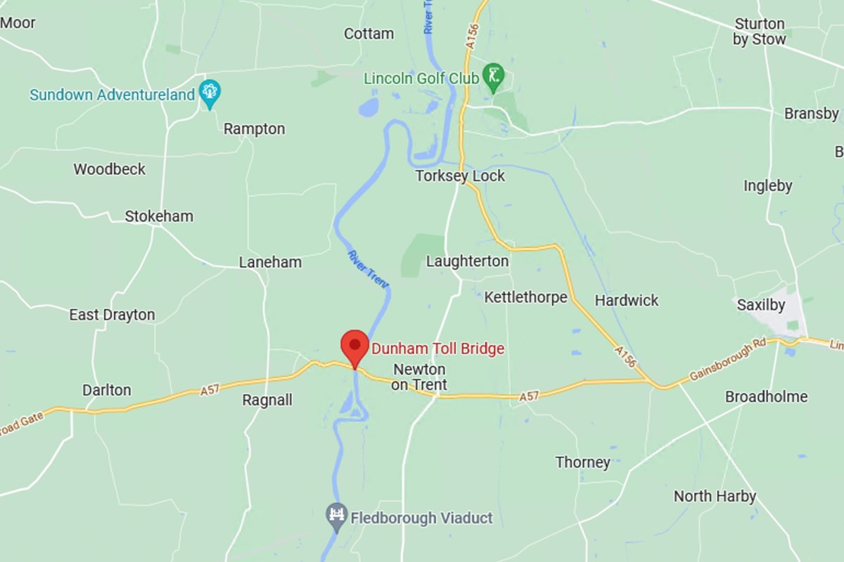
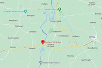
Dunham Bridge
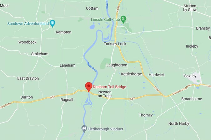
Where is it found? Crossing the River Trent on the A57 between Nottinghamshire and Lincolnshire, Dunham Bridge is north of the Fledborough Viaduct.
How much does it cost and how do I pay? Cars and minibuses up to 16 passengers pay an earth-shattering 50p, Vans, motorhomes and bigger coaches pay £1 and six-wheelers and agricultural vehicles pay £2, all including VAT. There is a weight restriction in place for HGVs, which cannot exceed 44 tonnes.
Pedestrians, cyclists and motorbikes can use the bridge free-of-charge, though they are expected to stop at the toll booth before proceeding.
Payment can be made in cash, but a pre-payment scheme is available for cars, offering a small but unspecified discount, at a cost of £20 for cars and £30 for vans and lorries.
What’s the alternative route? Via Gainsborough A156 or Newark-on-Trent A1/A46 or across the A631 in Gainsborough, to the north.

Durham Road User Charge Zone
Where is it found? In the ‘Durham City Peninsula’ in a curve in the River Wear, essentially the area around Durham Cathedral and Castle, Durham Market Place, some of the university colleges, and some of the shopping areas.
How much does it cost and how do I pay? The zone applies from 10am to 4pm on Monday to Saturday, so you won’t need to pay outside of those times, nor on Sundays or bank holidays.
Using the zone during these times has a £2 daily charge and is enforced by ANPR. You must pay by midnight on the day of using the zone to avoid a £50 penalty charge, and payment is accepted via Pay By Phone (with the location code 804250), online payment, or in person at The Parking Shop, inconveniently located a couple of miles away in north Durham.
What’s the alternative route? As the zone is essentially a peninsula you can avoid it entirely if you’re simply passing through, as the A690 dual-carriageway doesn’t go through the zone. The zone is also small enough that to avoid paying during charging times, it makes more sense parking outside and walking in if you’re visiting somewhere inside the zone.
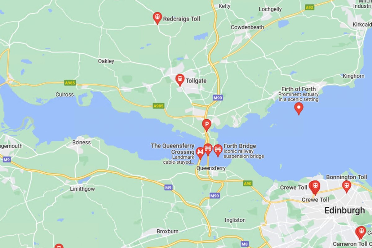
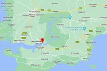
Forth Road Bridge
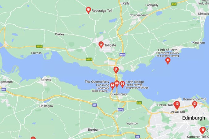
Where is it found? A world-renowned suspension bridge, being the longest outside of the USA, the Forth Road Bridge opened in 1964 and spans the Firth of Forth connecting Edinburgh on the south side to Fife on the north side on the A900.
How much does it cost and how do I pay? Though tolls were part of the Forth Road’s maintenance, in 2008 the Scottish Government moved to abolish toll roads, so both the Forth Road Bridge and Queensferry Crossing, alongside it, are free to cross.
What’s the alternative route? Kincardine Bridge, 27.5 miles west will also take you across the Firth of Forth
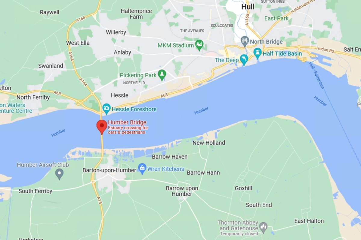
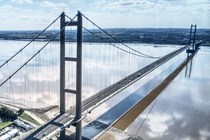
Humber Bridge
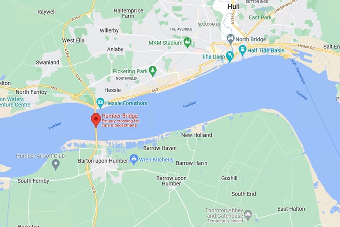
Where is it found? On the A15, west of Kingston-upon-Hull, crossing the River Humber
How much does it cost and how do I pay? Motorcycles and trikes are free, cars and motorhomes up to 3.5 tonnes are £1.50, 2-axle vehicles and minibuses are £4, and vehicles with three axles or more now attract a hefty £12 charge. There’s a 10% discount with a HumberTAG and you can pay Contactless, Chip & Pin, Apple/Google/Samsung Pay
What’s the alternative route? If you go 25.5 miles west, you’ll hit the M62, which will take you across the river at Kilpin Pike, Goole.
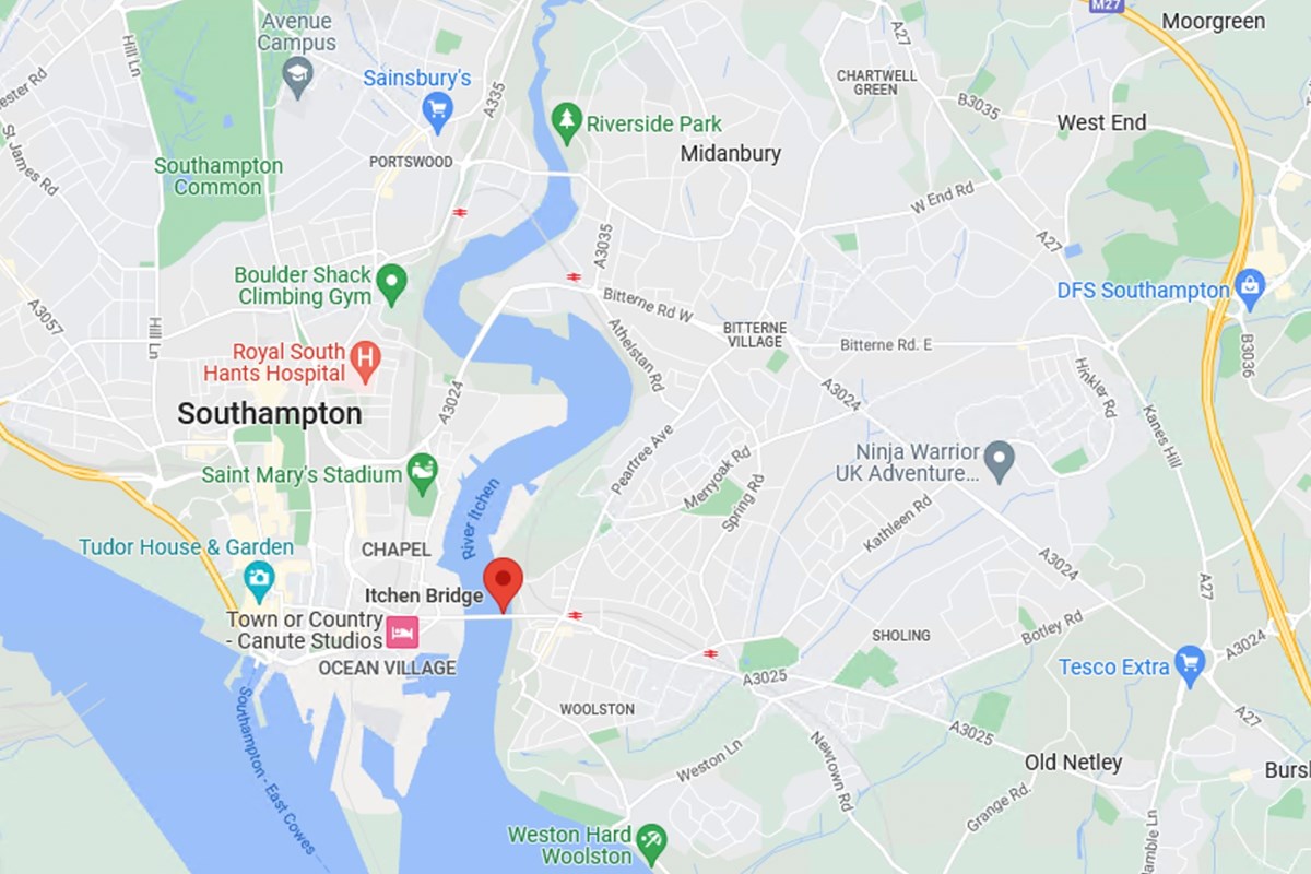
Itchen Bridge
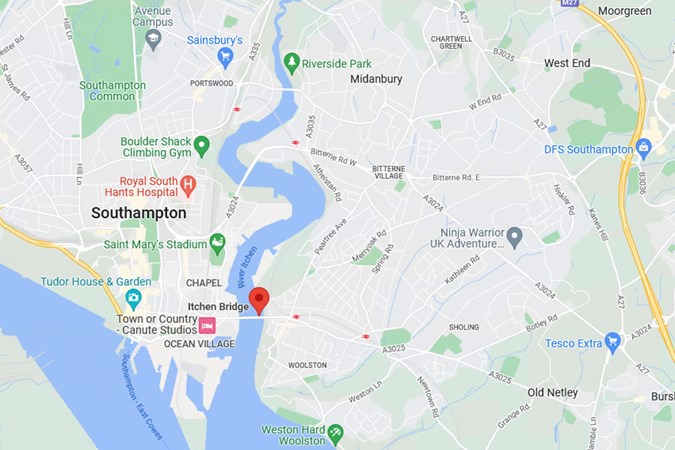
Where is it found? On the A3025 travelling east to west into Southampton city centre
How much does it cost and how do I pay? Since Itchen Bridge’s pricing model depends on the class of vehicle, time of day and whether you qualify for any concessions, e.g. being a resident, (arguably the most complex arrangement we have on this list), we’ve put the table of charges below, but very broadly speaking motorcycles are free, cars cost £1, vans and 4x4s cost £1.40, and HGVs, buses, and other vehicles more than 2.39m tall cost £40.
What’s the alternative route? A couple of miles north, there’s another road across the Southampton Water. Or even further north, the M27 will avoid it completely.
M6 Toll
Where is it found? Between Coleshill (junction 4a) and Wolverhampton (junction 11) on the M6 in the Midlands
How much does it cost and how do I pay? The M6 features ‘zones’ which dictate how much you pay depending on how long you spend on the road, but motorcycles are between £3.30 and £4.70, and cars from £6.20 to £9.90. Payment methods and cost depend on whether you have an M6 ‘TAG’ – with it, the car cost drops from the figures above, to £4-£8.90. On the approach to the toll plaza, machines will accept contactless or card payments, but no cash.
What’s the alternative route? Avoid paying the M6 Toll charges by staying on the M6 motorway. If you need to be closer to the northern arc of the M6 Toll, you’ll be able to navigate along the A5 and pick up the A452. Alternatively, if you’re coming up from the south and need to be somewhere to the east, the M42 runs parallel with the M6 Toll for a short stretch.
Mersey Gateway
Where is it found? A533 joining Runcorn to Widnes, across the River Mersey.
How much does it cost and how do I pay? Motorcycles and local buses are free, while cars and vans of up to eight seats and under 3.5 tonnes pay £2.30 as of April 2025. Discount can apply, reducing the price to as little as £1.50 if certain criteria are met, and monthly passes are available costing £75 for off-peak or £110 unlimited travel – the latter breaking even if you do more than 45 peak-time journeys per month (so about 23 days of commuting).
Payment can be made online at www.merseyflow.co.uk (24/7). By phone on 01928 878 878 (8am-8pm Mon-Fri, 9am-6pm weekends and bank holidays). There’s an automated service on the same number too.
What’s the alternative route? Travelling north east to pass through Warrington or travelling further west to use the Mersey tunnel (see below).

Mersey Tunnels
Where is it found? A41 for Queensway and A59 for Kingsway across the River Mersey at the most western peninsula.
How much does it cost and how do I pay? As of April 2025, cars and bikes pay £2.30, vans, cars with trailers and minibuses £4.60, trucks and coaches £6.90 and HGVs £9.20. Discounts are applied for those with T-Flow accounts and Liverpool residents get further discount (down to as little as £1.50 for cars and bikes).
Mersey Tunnels offers a range of alternative payment options and customers can pay the toll fee by Credit or Debit card or Cash if they do not want to register for T-Flow. T-Flow is a video tolling system that reads your vehicle’s registration as you approach the toll lane and deducts the payment from a pre-paid account.
What’s the alternative route? Travelling north east to pass through Warrington or travelling further east to use the Mersey Gateway (see above).
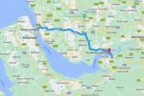
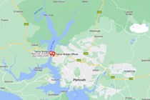
Tamar Bridge
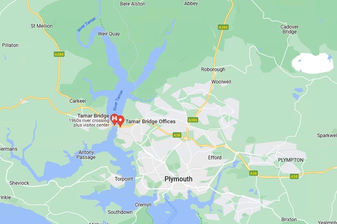
Where is it found? Crossing the River Tamar on the A30 to the west of Plymouth, the Tamar Bridge has its own visitor centre
How much does it cost and how do I pay? The toll for the Tamar Bridge is payable one way, on the trip from Saltash (Cornwall) to Plymouth (Devon). Motorcycles ride across for free. Cars (including quads, trikes, and sidecars) and small vans can travel for £2.60, larger vans and coaches for £6.30, three-axle vehicles for £10.40 and £14.30 for four axles or more. All prices double if there’s a trailer involved, and half if you’ve got a TamarTAG. You can pay with cash or card at the bridge.
What’s the alternative route? Take the A386 as far north as Tavistock and continue your journey.
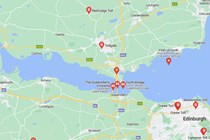
The Severn Bridges
Where is it found? M48 and M4, England to Wales.
How much does it cost and how do I pay? Good news, as the Severn Bridge has been toll-free in both directions since December 2018.
What’s the alternative route? The bridge can from time-to-time be closed due to weather conditions. As such the A38 from Tockington to Gloucester and then A48 from Highnam to Chepstow will keep you on your way.
Tyne Tunnel
Where is it found? On the A19 between South Shields and North Shields under the River Tyne.
How much does it cost and how do I pay? Bikes are free, it’s £2.40 for cars, and £4.80 for vans or larger vehicles. Disabled drivers are exempt. A 10% discount is on offer if you register with the operator TT2 and credit a prepaid account.
Payment is made four ways: Prepaid, pay-for-passage (which is a pay-as-you-use online mechanism), by phone or by paypoint at the toll plaza.
What’s the alternative route? The Tyne does have several other options for crossings, though all are further west than the Tyne Tunnel, adding various amounts of time to your journey depending which two dots you’re trying to connect. First is the iconic Tyne Bridge on the A167, with the smaller Swing Bridge just beside it, and the Redheugh Bridge on the A189 a little further upriver. Meanwhile, the A1M north and southbound will take you over the river at Team Valley (just north of the Metrocentre). This route will (eventually) get you further north towards the airport and up to the Scottish Borders.
Other UK toll routes
There are a series of smaller bridges located around the UK which also serve as toll roads, usually with fees that you can scrape together with spare change lying around your car. These include:
- Whitchurch Bridge (B471, Pangbourne, Berkshire, 60p for cars, 45p with a bridge card)
- Clifton Suspension Bridge (B3129, Bristol, £1 for motor vehicles)
- Whitney-on-Wye Bridge (B4350, Whitney-on-Wye, Hereford, £1 for motor vehicles)
- Swinford Bridge (B4044, Swinford, Oxfordshire, 5p – yes, that’s five pence – for motor vehicles)
- Warburton Bridge (B5159, Warburton, Greater Manchester, £1 for motor vehicles)
- Aldwark Bridge (Boat Lane, Great Ouseburn, Aldwark, North Yorkshire, 40p per crossing)
- Kingsland Bridge (Shrewsbury, Shropshire, 20p for motor vehicles)
- Cartford Bridge (Cartford Lane, Preston, Lancashire, 50p for cars)
FAQs
-
How many toll roads are in the UK?
There are just a handful of toll roads in the UK — fewer than you might expect. In fact, the M6 Toll is the only tolled motorway, with the rest made up of bridges, tunnels, and a few private roads.
In total, there are around 20 toll routes across the country, covering major river crossings, estuary tunnels, and some small privately maintained roads. Most tolls are under £5 and vary depending on the type of vehicle you’re driving. -
Can you pay toll roads with card?
Yes, most UK toll roads, bridges and tunnels accept credit or debit card payments, either at the barrier or online. Some use automatic number plate recognition (ANPR), so there’s no toll booth — you simply pay online afterwards (like the Dartford Crossing).
However, not all tolls accept cash anymore, and a few smaller or private toll routes may still be cash-only or require prepaid tags or accounts (like T-Flow on the Mersey Tunnels). Top tip from us, always check the payment method in advance, especially for less well-known toll routes. You don’t want to be caught out without the right payment option. -
What happens if you don’t have money for a toll road in the UK?
If you don't have money or the right payment method at a UK toll, what happens next depends on the toll system in place. For automatic tolls like the Dartford Crossing or Tyne Tunnels, there's no physical barrier – instead, your number plate is recorded and you’re expected to pay online by the deadline (usually by midnight the following day). Miss that, and you'll be hit with a penalty charge, often starting at £70 or more.
At manned booths or card machines, like on the M6 Toll, staff may offer a payment notice that lets you pay later – but this is at their discretion and repeated non-payment can lead to fines or enforcement action. -
Who owns toll roads?
Toll roads, bridges and tunnels in the UK are owned and operated by a mix of private companies, local councils and transport authorities. For example, the M6 Toll is privately owned by Midland Expressway Ltd, while the Dartford Crossing is run by National Highways – a government body – even though you still have to pay a charge.
Others, like the Mersey Tunnels, are managed by local authorities such as Merseytravel. You’ll also find a few smaller toll roads and bridges owned by private estates or local trusts, each with their own prices and rules. So while toll routes aren’t that common in the UK, ownership and how you pay can vary – it’s worth checking in advance to avoid any surprises. -
Are toll roads VAT charged?
Most UK toll roads, bridges and tunnels do not charge VAT on the toll fee. That means the price you see is the final amount you’ll pay – there’s no extra tax added on top. However, there are some exceptions. For example, the M6 Toll does include VAT, and if you're a business, you can usually reclaim it. If you're unsure whether VAT applies to a specific toll, check the receipt or the operator’s website – they’ll usually state whether VAT is included.
Just so you know, we may receive a commission or other compensation from the links on this website - read why you should trust us.